- India
- International
Thursday, Apr 25, 2024
Journalism of Courage
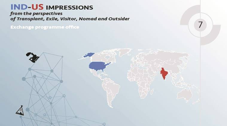 The graphic was uploaded on its Facebook page.
An event poster put out on CEPT University’s Facebook page sparked outrage among the varsity’s extended student and alumni community after a graphic depicting the world map highlighting India and USA, showed India without the north-eastern states. The event ‘Indo-US impressions: from the perspectives of Transplant, Exile, Visitor, Nomad and Outsider’ was hosted by CEPT Country Club (CCC) — a platform for CEPT’s foreign students and faculty.
“Remove the post asap,” went one reaction from Jaimeen Trivedi on the varsity’s public page to the poster, while another FB going by the name of Shravani Sharma wrote, “We don’t exist anymore. Where is north-east?”
A faculty who was part of the organising team called the gaffe “unfortunate accident” and said, “The poster was meant to be a graphic and not a strict map of the world, just to locate both countries.
It was a mistake and this is something that was noticed at the last minute, the poster was prepared by two Italian students. It was made in haste and clearly there was no intention to be offensive to anyone.
Apologies have been written to everyone ? institute officials, even students ? statements have been made to all the concerned faculty involved and the President’s office.”

By late Tuesday evening, the page was updated with a map which showed India’s north eastern region duly filled in and the poster was changed on Facebook. And both comments reacting to the map, had been deleted. Anne Feenstra, Dean, Faculty of Architecture, CEPT University’s who had flagged off the initiative said, “It was a graphic done by two Italian students and they took the world map and highlighted America in blue and India in red.
This map is not about depicting country borders that’s not the point. It’s a graphical depiction of two countries to show the geographical distance ? it’s not about borders. The discussion was about what is different and what do they have in common.”
Engineering in local language sees uptick in students in UP,Subscriber Only
How Bengaluru’s lakes disappearedSubscriber Only

UPSC Key | Ethylene oxide, SIPRI Report, organ transplantsSubscriber Only
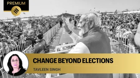
I met nobody in rural India who saw Modi asSubscriber Only

India’s trade with Israel & Iran, and impact of regionalSubscriber Only