1 Grassington, Yorkshire dales
Length: 11 miles
Time: 5½ hours
Start/finish: Grassington National Park Centre (Google map/OS Explorer OL2)
Grade: Moderate
Refuel: Craven Arms, Appletreewick
The Guardian’s product and service reviews are independent and are in no way influenced by any advertiser or commercial initiative. We will earn a commission from the retailer if you buy something through an affiliate link. Learn more.
Anyone who grows up in or around the Yorkshire dales ends up carrying it with them. There’s something about the crumpled-duvet landscapes of emerald field and heathery fell, about encountering its sudden, Shire-like valleys threaded with muscular peat rivers, about stumbling across a ruined abbey at dusk or drinking well-earned beers by pub fires that forever sticks in the head and the heart.
One of the national park’s greatest pubs has to be the Craven Arms at Appletreewick (mains from £8.95). Tucked into the fell above the river Wharfe, and the halfway point of a wonderful 11-mile circular walk from Grassington, it could go toe to toe with anywhere for the title of “perfect country pub”. Its standout feature is the “cruck barn” at the back, built by the owner using traditional materials and the first in the dale for 400 years.
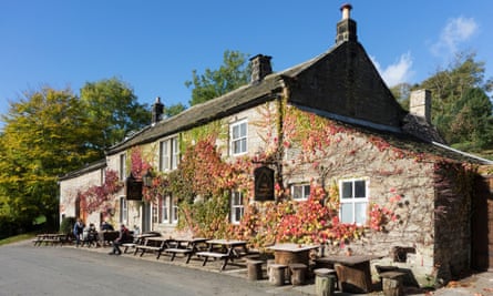
Reaching the Craven Arms from the village of Grassington is akin to drinking a neat shot of the dales. Cross the river by the photogenic Linton Falls before climbing up to the gorgeous hamlet of Thorpe through fields threaded with dry-stone walls. Carry on through meadows where lapwings “pee-wit” and a stray foot may startle a hare into pulsing flight, to reach Burnsall and what has to be the most photographed bridge in the dales. Cross the river and follows signs for Appletreewick, and find the Craven Arms close to the Mock Beggar Hall, an old monastic grange that testifies to the village’s connection to nearby Bolton Abbey. Below the pub is a fantastic wild swimming spot.
The five and half miles back are most atmospheric if you time it to arrive in Grassington at dusk. Return to Burnsall and then take the historic riverside path north-west, crossing the suspension bridge at Hebden. Along the way enjoy woodsmoke from farmhouse chimneys; the quiet grandeur of autumnal trees bronzed by late light, ground mist around their roots; the gurgling rush and calm of the river; and the unforgettable, far-reaching fells, alive with the bleats of Swaledale sheep, gradually bruising into black.
Rob Cowen, author of Common Ground (Cornerstone), voted one of the Guardian readers’ top 10 books of 2015
2 Nidd Gorge, North Yorkshire
Length: 7½ miles
Time: 3½ hours
Start/finish: Sustrans 67 junction with Bilton Lane (Google map/OS Explorer 297)
Grade: Moderate
Refuel: Carriages, Knaresborough
Autumn’s true glories are experienced through trees: the turning of leaves from greens to fiery yellows and reds; the wine-black clusters of berries and nuts on drooping branches; the musty smell of leaf litter as shafts of sun streak the damp earth.
A mile from my home on the northern edge of Harrogate, a thickly wooded river gorge provides the perfect stage to witness the splendour of autumn.
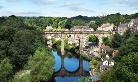
Enter the Nidd Gorge by following the Sustrans cycleway 67 from Bilton to the defunct Victorian viaduct that spans the river. After taking in the viaduct’s views, descend and wind along for four miles of sylvan splendour to Knaresborough, slowing to the river’s pace and stepping through the dioramas of alder, oak, beech, chestnut, birch and waterside pines that lean over the mirror-like surface to create breathtaking patterns with their reflections.
There are kingfishers here; buzzards and dippers too. Once I watched for 10 minutes as an otter threaded its way between bank, tree root and water, fishing for trout. Expect some mysterious, melancholic human traces, too – weirs and old mills reduced to rubble, strange caves – before the stunning reveal of Knaresborough’s commanding (and still-working) railway viaduct, the town’s tumble of handsome houses and, perched above, the ruins of Knaresborough Castle.
Walkers can break the circuit at Carriages (£10.95 for two courses at lunchtime), where the food is plentiful and delicious.
The return loops back along the Beryl Burton cycleway (Sustrans 636) and above the trees, on to the high ground from where Cromwell’s cannons pounded the royalist castle. Skirting the woods – stopping to pick sloes and crab apples – you may see roe deer, reminders of when this area was part of the medieval Royal Hunting Forest of Knaresborough.
Passing 17th-century Bilton Hall, follow the old track through the furrowed farm fields and the flaming trees back to the start, completing an idyllic autumn circuit. RC
3 Llyn peninsula, Gwynedd
Length: 4 miles
Time: 2 hours
Start/finish: Edern village (Google map/OS Explorer 253)
Grade: Easy
Refuel: Ty Coch tavern, Porthdinllaen
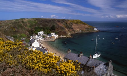
The Ty Coch tavern (mains from £9.95), in Porthdinllaen on the old pilgrim route to Bardsey Island, exercises an inexorable pull for pilgrims of every creed as walkers, sailors, fishermen, golfers and lovers of craft beers converge on this beachfront pub.
The village used to be a substantial community, with a sailmaker and a coaching inn for travellers sailing to Dublin. Today, a handful of fishermen catch whelks, scallops and lobsters, and the Ty Coch is the only pub. The landlord, Stuart Webley and his family are the beach’s last permanent residents.
An excellent circular (clockwise) walk to Porthdinllaen starts in the inland village of Edern (park by the Ship Inn). Take the footpath from the wooden footbridge next to the butcher’s shop along the western bank of the Afon Geirch. Head north in the direction of the coast. Cross the stream in front of Porthdynllaen Farm and follow it until you meet the farm track, then hard left until you pick up the footpath again on the other side of the farmyard.
Pass by the campsite at the farm and follow the river, now on its eastern bank, to the rocky beach at Abergeirch. Stone steps will take you to the cliff path – the Wales Coast Path. A colony of seals live off the rocks at Life Boat Bay. When mackerel are in season it’s not unusual to see a pod of dolphins from the cliff. Rejoin the beach at Life Boat Bay and follow the coastal path to the Ty Coch.
Proud to be a chip-free zone, the Ty Coch provides carbs in a superb list of bottled craft beers, two local tap beers and a revolving guest ale. The saloon is the beach, with a great view of Anglesey, though you’d be surprised how many people can cram inside when it rains.
After lunch continue along the beach to Morfa Nefyn, enjoying superb views of the Yr Eifl hills until the road meets the beach below the Cliffs pub. Walk straight over at the crossroads, then turn right at the T-junction and take the footpath along the B4417 back into Edern. An alternative that avoids the road is to cut back across the golf course and follow the coastal path back to Abergeirch. To do this turn right (past Café Porth Dinllaen) instead of heading straight at the crossroads.
Katharine Norbury, author of The Fish Ladder (Bloomsbury)
4 Lingmoor Fell, Lake District
Length: 5 miles
Time: 3 hours
Start/finish: Elterwater village (Google map /OS Explorer OL7)
Grade: Moderate
Refuel: The Brittania Inn
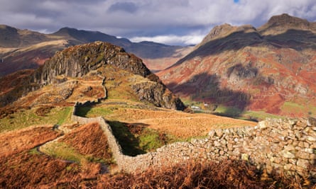
Lingmoor Fell, at 469m, is a modest climb from Elterwater village but steep enough to give a sense of achievement. It stands alone, affording superb views beyond Elterwater to Windermere. Head south out of the village, crossing the stone bridge over Great Langdale Beck and turn right and follow the lane (marked “Coniston challenging option” for cycles) alongside Sawrey’s Wood. It soon becomes a rough track, and at Dale End Farm (about a mile from the start) you will see the gate up on to the fell.
The trail is the old quarry path. A slate seat below the summit affords lovely views and you could follow this path to just below the summit, but I would follow the path along the ridge wall for a while instead and enjoy the views of Great Carrs, Wet Side Edge and Harter Fell. Descend by the same route and enjoy the views of Little Langdale Tarn. There is an alternative track that descends steeply into Sawrey’s Wood and begins a little to the east of the quarry path, though it can be tricky to spot. Do take a map!
The Brittania Inn (mains from £12) at Elterwater jolts you back 500 years with its low roof and whitewashed facade. Anna and Andrew Parker have run it since 1978 and the welcome is always warm, the food substantial. There is a great range of ales with names such as Neddy Goggle, and several brewed for the pub, including Britannia Gold. KN
5 Hay-on-Wye to Rhydspence, Wye Valley
Length: 6 miles
Time: 2½ hours
Start/finish: Offa’s Dyke footpath sign on the right after the main bridge out of town (Google map /OS Explorer 201)
Grade: Moderate
Refuel: The Rhydspence Inn, Whitney-on-Wye
Setting out from the famous book town of Hay-on-Wye, this six-mile stroll starts along the western edge of the Wye. Immediately after the bridge, follow the path through an elevated riverine copse before dropping down to the banks. After a couple of miles along the valley floor, the path reaches Bronydd Farm. To avoid the busy A438, leave Offa’s Dyke here and head up to the steep pitch behind the roadside hamlet of Bronydd. The path eventually brings you out at Bettws Dingle, where you turn briefly west before heading back on yourself towards the river. Zigzagging along the contours of the hills will take you past Upper Bettws farm and on to Old House. Just before reaching the latter, bend right along the track and down through an old wood. Then it’s all downhill to the pub.
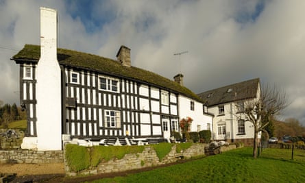
A splendid 14th-century coaching house, the Rhydspence Inn has been welcoming footsore travellers for centuries. The exterior is a gorgeous assemblage of squiggly timber beams and off-kilter windows. If a building could be happily sozzled, this age-old public house would be. At the rear, the garden slopes down towards the Wye: a perfect spot for a pint on a sunny afternoon. Along the southern perimeter, a brook marks the England-Wales border, its narrow banks keeping St George and the Dragon at arm’s length.
Inside, the atmosphere of a traditional country pub lives on, from the heavy oak front door and creaking corridors to the cubbyhole bar and open-hearth fire. Upstairs are seven bedrooms with delightful views.
The bar menu features all the pub favourites – steak and ale pie, lasagne, scampi, fish and chips, at around £10 – alongside baguettes and ciabatta rolls at lunchtime. The restaurant menu is a little more ambitious, with starters that include Thai fish cakes and smoked duck breast salad. For mains, the options are fairly meat-heavy (this is hill farmers’ country, after all). Welsh lamb casserole (£15) is a favourite.
Oliver Balch, author of Under the Tump: Sketches of Real Life on the Welsh Borders (Faber)
6 Llyn y Fan Fach, Brecon Beacons
Length: 6½ miles
Time: 3 hours
Start/finish: The free car park outside Llanddeusant village (Google map/OS Explorer 12)
Grade: Moderate
Refuel: The Tanners Arms, Defynnog
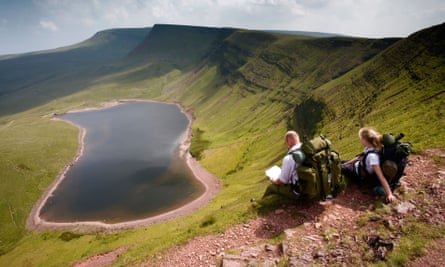
In the western Brecon Beacons, Llyn y Fan Fach (literally “lake of the small beacon-hill”) is an overlooked gem. From the village, follow a steep stony track for about 40 minutes to the lip of the now-dammed glacial lake. Encircled above by a searing escarpment, this magnificent oval-shaped expanse of cold cobalt blue is rich in myth and mystery (the most popular folktale tells of a beautiful fairy girl rising from the lake and begetting three sons who would become famed physicians).
A looping path climbs westwards up the ridge above the lake and eventually round to the summit of Picws Du. On a clear day, the panoramic views are some of the best in Wales: Swansea Bay to the south, then the Pembrokeshire coast, the Epynt northward and then eastwards over the Brecon Beacons.
Continue along to the spur of Fan Foel and then down to the gully on the far side, where a faint path leads you off the mountain and back to the lake below. For a longer walk, carry on after Fan Foel to Fan Brycheiniog and then descend to a second, larger glacial lake (Llyn y Fan Fawr). Loop around the water’s southern edge and then circle back along peaty moorland to the start.
Because of the walk’s remoteness, the nearest pubs all require a short drive. For a classic locals’ hang-out, you can’t beat the Tanners Arms in nearby Defynnog. Run by the ever-amiable Brenda and her chef-husband Alan, this cosy freehouse is a particular dream for craft ale and cider lovers. The walls are decorated with hundreds of pump clips, each denoting a bygone barrel consumed on the premises. Current specials on the cider board include the joyous-sounding Hairy Ferret, Crazy Goat and Farmer Jim’s Rootin Tootin. There’s even a zero-alcohol “beer” for dogs too (chicken or beef flavours, £2 a bottle).
Food is served either in the bar area or in a smart dining room next door, on the walls of which hang prints by local photographer Martin Dyde.
Given the pub’s location in the heart of rural Wales, entrées of Chinese duck spring rolls, Spanish dried meats, Japanese miso soup and onion bhajis speak to a surprisingly cosmopolitan palate. There’s no messing with the main dishes, which are solid, appetite-appeasing walkers’ fare from start to finish, such as lamb shank and pumpkin curry pie. OB
7 Canvey Island circuit, Essex
Length: 13 miles
Time: 5 hours
Start/finish: Benfleet station (Google map/OS Explorer 175)
Grade: Easy
Refuel: Lobster Smack, Haven Road
To access this pleasant but slightly desolate former holiday location, take the train to Benfleet, from where you can walk across the bridge on to Canvey Island, home to Dr Feelgood and recently chronicled in Julian Temple’s film Oil City Confidential. Turn right straight after the causeway, and follow the path that takes you round the island anti-clockwise. This leads first to empty grassland edged by deep narrow inlets marking the edge of the island and criss-crossed by drainage ditches. The walk is straightforward, easy to follow and surprisingly varied.
Keep the water to your right and eventually arrive at the Thames by the oil storage depot. Great jetties like a giant’s extended fingers reach out into the river all around you, and then, having probably not seen a soul all morning, you arrive at a caravan park and then a pub in quick succession. You are just about halfway round the island by now. The pub is the Lobster Smack, which is pretty and wooden from the outside and cosy inside, with decent pub grub. I had the beer-battered cod and chips (£9.79) accompanied by a pint of Blue Moon (without a slice of orange).
If the landscape so far reminds you of every TV adaptation you’ve ever seen of Great Expectations and you’ve found it hard to shake off the image of Abel Magwitch being pursued across the mudflats, it’s not surprising, because the Lobster Smack is the inn in the Dickens novel.
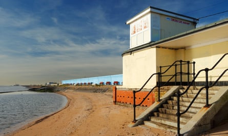
Restored, press on round the island, following the sea wall with its vibrant graffiti, past the lure of amusement arcades and a small beach. Canvey became a fashionable place for Londoners to visit during the Victorian era after its air was promoted as having healing properties.
Turning away from the Thames, continue round to the creeks and an old harbour, a dangerous eerie empty landscape of mud and brown water. Then there are new developments of large detached houses, a golf course and the view back to Hadleigh Country Park and the wooded Benfleet Downs on the mainland, a world away from this treeless, flat, low-lying island. Return to the causeway to Benfleet station in the near distance.
Des Garrahan, chair of The Ramblers
8 Richmond to Hampton Court, Surrey
Length: 8 miles
Time: 4 hours
Start: Richmond station (Google map/OS Explorer 161)
Finish: Hampton Court station (Google map)
Grade: Easy
Refuel: The Boaters Inn, Kingston upon Thames
Not everyone associates Richmond with rock’n’roll, but exit Richmond station using the main entrance and straight across the road is the site of the Station Hotel, where the Crawdaddy Club debuted a host of famous acts during the 1960s, including the Rolling Stones.
Cross the road at the traffic lights and go down Old Station Passage. Turn left at the end and walk a few yards until you get to Richmond Green. Cross the common, using the paths on a diagonally right direction, aiming for Old Palace Lane. Follow Old Palace Lane until you reach the river and turn left. Walk with the river on your right and go under Richmond Bridge. Continue with the river on your right as you leave the town behind and you enter countryside.
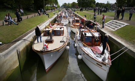
The river begins a gentle curve to the right and you’ll walk past Petersham Meadows, with its herd of cows. Enjoy the sights, sounds and smell of the river as you head towards Ham House. You’ll be about three miles into your eight-mile walk now. With the river still on your right, not far past Ham House, you see Eel Pie Island in the middle of the river. The island was the site of the now legendary Eel Pie Island Hotel where artists including the Rolling Stones, The Who, Rod Stewart and Eric Clapton performed regularly throughout the 1960s.
Keep pushing on past Teddington Lock and with the suburbs of Kingston emerging, you will soon arrive at Canbury Gardens riverside park. Here you’ll find the Boaters Inn. You’ve now walked nearly five miles and will have earned something to eat and drink. I had vegetarian kedgeree with hard-boiled egg, marinated tofu, curried rice, red chilli, parsley, spring onion and cashews (£12). Looking around, the beer-battered cod (£12.50) seemed very popular. There’s a constantly changing parade of local beers and I washed my meal down with a pint of Dark Star Hophead.
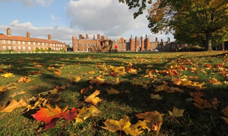
After leaving the pub, stick to the riverside with the river still on your right until you come to Kingston Bridge. Cross the bridge and turn immediately left, heading down to the riverbank, with the river on your left. Continue walking alongside the river as it makes its majestic sedate way to Hampton Court Palace. This part of the walk is approximately three miles. You can’t help but be impressed with the history on show here (but be aware that entry to the palace and gardens costs a hefty £19.80). Cross over the river once more on Hampton Court Bridge and Hampton Court station, with its regular trains back to Richmond or London’s Waterloo, is right in front of you. DG
9 Glen Finglas, Trossachs
Length: 4 miles
Time: 2 hours
Start/finish: Woodland Trust car park, A821 (Google map/OS Explorer OL46)
Grade: Easy
Refuel: The Byre Inn, Brig o’Turk
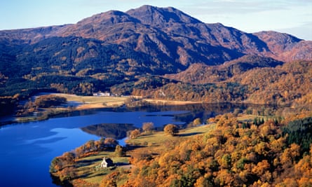
In the 20 years since Glen Finglas was removed from the grasp of commercial forestry, I have watched with wonder as it has transformed into burgeoning native woodland. Autumn is its finest hour. The scented calm of old oakwood greets you at once at the Woodland Trust centre, where visitors can browse through leaflets giving details of colour-coded walks. This one is called the Brig o’Turk Loop and involves a climb on good paths up the lower slopes of hills that reach 600m. As the oak thins out, a self-sown birchwood reclaims the land from the felled spruces. Scots pine, willow, rowan, alder and hazel insinuate themselves into the mix.
The path contours a south-facing hillside with views across lochs, foothills and the majestic miles of the Great Trossachs Forest to Ben Venue above Scott’s Loch Katrine. Watch out for red squirrel, black grouse, golden eagle and pine marten. Drop down to a low path that circles back to the start.
The Byre Inn (mains from £9.95) at Brig o’Turk specialises in locally sourced game and fish and micro-brewery ales. The starter of your dreams is oatmeal-rolled haggis fritters. Log fires, of course.
Jim Crumley, author of The Nature of Autumn (Saraband)
10 Sligachan, Isle of Skye
Length: 12 miles
Time: 6 hours
Start/finish: Sligachan (Google map /OS Explorer 411
Grade: Moderate
Refuel: Sligachan Hotel
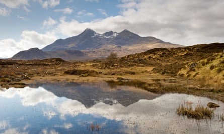
Sligachan is a sea loch, a middle-of-nowhere hotel, and the most unforgettable glen in all Scotland. Unforgettable, because to walk there is to journey into a twilight world of hard rock and Celtic legend, and the sculptural glories of Scotland’s mountain masterpiece – the Cuillin. The Sligachan track takes a spectacular route between the superb peaks of Marsco on your left and Sgurr nan Gillean on your right.
The best low-level walk is to follow the glen south to Loch na Creitheach, tranquil but sensationally situated under the south ridge of the Cuillin’s aloof outlier, Blà Bheinn. Then just walk back the way you came. If luck is with you, a sprinkling of snow will embellish the peaks and stags will roar in the dusk.
Seumas’ Bar in the Sligachan Hotel (doubles from £60pp B&B) has been chosen Scotland’s Whisky Bar of the Year for three consecutive years and has 400 single malts. It also sells craft beers from the adjacent Cuillin Brewery. Freshly landed seafood is a speciality, as is venison pie. JC
11 Wells Beach, Wells-next-the-Sea, north Norfolk
Length: 4½ miles
Time: 2 hours
Start/finish: Beach Road car park, Wells-next-the-Sea (Google map/OS Explorer 251)
Grade: Easy
Refuel: The Albatros, Wells
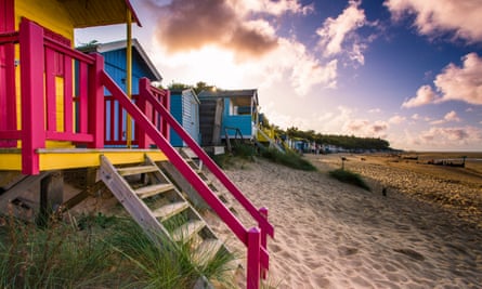
Parts of the coast are southern Britain’s last wild frontier, a place of space and peace, unchanged by human habitation. It is the illimitable horizon and vast open beach that first dazzle the visitor to Wells-next-the-Sea: this windswept space is intoxicating. At low tide it’s possible to imagine you’re in a desert until the tide creeps up with swift stealth.
An easy two-hour stroll is to take the footpath westwards into the pine woods at the far end of the beach car park at Wells. This becomes a sheltered grassy track at the edge of the woods where you can bump into muntjac deer or watch skeins of pink-footed geese and wading birds drawn to the wet fields in winter. At Holkham, you can turn through the pines on to the vast beach and head back east to Wells, keeping an eye out for seals, oystercatchers and other shoreline birds.
This is a particularly beautiful walk in autumn and winter, when there is more chance of encountering coastal wildlife. And even when it is busy, you can always find space and solitude on such an expanse of sand. My tip is to check the wind direction when you set out and do this walk whichever way round ensures that the wind is at your back on the beach.
After a fresh-air buffeting, you may require some refreshment; follow the coast path up the channel to the port of Wells, where you’ll find the Albatros moored on the Quay. This is an atmospheric, ramshackle-in-the-right-way old boat that Dutchman Ton Brouwer used to sail over from Holland. He liked Wells so much that he stayed, and serves real ales to wash down kingsize savoury Dutch pancakes (from £5.75) and three-course lunches for £17.50.
If you wrap up warm, you can sit on deck, or go below to the cosy, friendly innards of the ship, where there’ll be games, good conversation and live music at weekends.
Patrick Barkham, author of Coastlines and The Butterfly Isles (Granta)
12 Fermyn Woods, Northamptonshire
Length: 2 miles
Time: 1 hour
Start/finish: Fermyn Woods country park near Brigstock (Google map/OS Explorer 224)
Grade: Easy
Refuel: The Chequered Skipper, Ashton
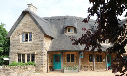
In 1975, a small brown butterfly abruptly vanished from England. Fortunately, the chequered skipper still thrives in the Scottish Highlands, but its only trace south of Scotland is a lovely thatched pub, the Chequered Skipper. It’s a beautiful country pub on the green of the village of Ashton (confusingly there are two Ashtons in Northamptonshire – this one is near Oundle), part of an estate founded at the turn of the 20th century by the great butterfly lover and conservationist Charles Rothschild. It offers fine Northamptonshire ales with an easy-going restaurant serving steaks, burgers, and dishes such as slow-roasted belly pork (£13.95) and polenta chips with roasted Mediterranean vegetables (£9.75).
The countryside around it contains some beautiful English woodlands, and some of the best butterfly territory in the country. There are some lovely lanes right on the pub doorstep, but I’d suggest a 10-minute drive to Fermyn Woods, a fragment of the old forest of Rockingham. Many of its conifers have been removed and the revived native wood has become one of the best places in Britain for the purple emperor, an elusive, iridescent butterfly that flashes purple and inspires obsessive devotion when it emerges in late June. At this time of year, it is a brilliantly camouflaged caterpillar but the rides of Fermyn remain a lovely walk.
If I’m in the area, I always call in at another nature reserve, Glapthorn Cow Pastures, which is even closer to the Chequered Skipper. This is a hidden gem, a mix of ancient woodland, meadows and blackthorn scrub, home to another rare butterfly, the black hairstreak. Like the purple emperor, this little butterfly with tiny tails on its wings has a cult following. PB
13 The Devil’s Dyke, Cambridgeshire
Length: 9 miles
Time: 4 hours
Start/finish: Barbara Stradbroke Ave, where the race course meets the Dyke (Google map /OS Explorer 226)
Grade: Easy
Refuel: The Dyke’s End, Reach
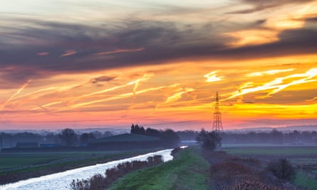
The Devil’s Dyke is a chalky, manmade trench-and-ridge earthwork, most likely built as an Anglo-Saxon defence. It rises out of woods and fields west of Cambridge, but this walk starts close to where it crosses into Suffolk by Newmarket race course (purple pasque flowers grow here and the grassy banks are good for butterflies).
The route then crosses the A14 on a footbridge back into Cambridgeshire and falls towards Reach green and a strikingly different landscape (sheep fields on this stretch attract migrating ring ouzels and wheatears in autumn). After Reach, the fens begin, with chalk replaced by peat, and the pathway bounces beneath your boots in a place that has not forgotten its swampy past.
The walk heads along the dyke’s watery extension, Reach Lode. Another manmade feature, this is an old waterway first dug, perhaps, in Roman times. Towards the newly rewilded Burwell Fen (where, in autumn and winter, short-eared owls quarter the air between barn owls, and visiting hen harriers jink between resident marsh harriers) the contours thin and the walk is below sea level. Then the skies grow up and Ely cathedral, gunmetal-grey on the western horizon, might be a beached whale or a stranded ship.
The Dyke’s End pub looks out on to Reach village green and is an excellent halfway stop on a there-and-back walk. Good walkers’ grub in the stripped-pine interior includes local sausages and mash (£11.50).
Tim Dee, author of The Running Sky, and Four Fields (Vintage)
14 The Quantocks, Somerset
Length: 8 miles
Time: 5 hours
Start/finish: In woods just past Bartlett Farm, Adscombe Lane (Google map/OS Explorer 140)
Grade: Moderate
Refuel: The Carew Arms, Crowcombe
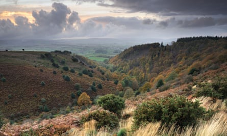
A walk over the top of the Quantocks in west Somerset from Over Stowey or nearby Adscombe to Crowcombe takes you from oak woodland up across a hog’s back of moorland and down again to the shelter of trees. The path is obvious so you shouldn’t get lost.
Linger, on your way up, between the silver of the many streams and the salad-green tree canopy, and feel yourself in a temperate rainforest. From the top, the moor gives great views across the tea-brown non-sea of the Bristol Channel. On wind-scoured autumn days, the Welsh hills on the far side seem at the tip of your fingers. Coleridge’s Ancient Mariner took shape in his mind as he walked these paths and scanned the prospects.
Night walking, which he did with William and Dorothy Wordsworth, can be beautiful here, too. Pick a moonshiny night and time your walk to allow for rest and recuperation at the Carew Arms in Crowcombe before retracing your steps. The bar has a stone-age feel, with an open fire and a great flagged floor. Daytime walkers find a welcome, too. It is exhilarating to have crossed the whole of a lowland mountain and celebratory eating and drinking can follow. The butternut squash lasagne (£9.50) is a hit. TD
15 Horsey Broad, Norfolk
Length: 8 miles
Time: 4 hours
Start/finish: Fishermans Return, Winterton (Google map/OS Explorer OL40)
Grade: Easy
Refuel: The Nelson Head, Horsey
With seagoing memorabilia all over its weathered redbrick walls, the Nelson Head like dozens of other pubs in the county, claims a direct link to Norfolk’s most famous sailor son. Unlike most, however, the Nelson’s Head is encircled by some of the most beautiful coastal scenery in the whole of East Anglia.
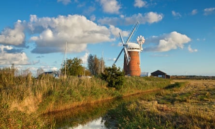
To the west lies the National Trust’s Horsey Broad, celebrated for its great sailing, its beautiful working windmill and the sounds of booming bitterns in spring. To the east – in fact the pub is within earshot of the waves – is the North Sea shoreline itself. In between is a great sand ridge that runs all the way south to Winterton Dunes, another national nature reserve and an eerily beautiful landscape noted for natterjack toads and sunbathing adders.
Recently, this stretch of coast has become known for the many Atlantic grey seals that haul themselves ashore from November onwards and give birth to one of the cutest sights in all of British nature: the doe-eyed, cream-furred pups.
Tens of thousands of people make the pilgrimage to ooh and aah at them, and those in the know stop off at the Nelson for lunch. The range of cask ales is huge and the menu, under the direction of a new chef, includes sandwiches (from £5.25), Cromer crab salad (£13.95) and fabulous burgers (from £12.95). All the meat comes from locally sourced ancient breeds.
As with the pub’s menu, visitors are spoilt for choice in terms of walking possibilities from the Nelson, and the wildlife at Horsey never disappoints. Marsh harriers are omnipresent. In winter, there are large flocks of pink-footed geese calling or wheeling across the vast skies, and Britain’s largest population of wild cranes.
One excellent option for a stroll with lunch is to park four miles down the coast at Winterton. There are ample opportunities for parking in the village centre, including a pay-and-display car park. Then follow the coastal path all the way through the Winterton Dunes reserve and along the landward side of the dune crest. The dunes and woods on the landward side are great for fungi in autumn (including the beautiful if poisonous fly agaric) and sparrowhawks or buzzards in all seasons.
After four miles you see the hamlet of Horsey with the Nelson Head. It is the first and only settlement north of Winterton. A clear track on the left, leading west into Horsey, takes you directly to it. For an alternative way back stroll by the sea and take in the fabulous gatherings of grey seals as you walk. Note that there are local access restrictions in the spots where the seals are in pup, but after these, for three miles of open beach, it is just you, the seals and the North Sea.
Mark Cocker, author of Birds Britannica (Chatto & Windus) and Crow Country (Vintage)
16 Combs Moss, Derbyshire
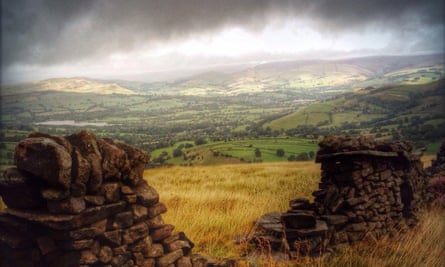
Length: 8 miles
Time: 4-5 hours
Start/finish: Northern end of Lightwood Road, Buxton (Google map/OS Explorer OL24)
Grade: Moderate
Refuel: The Beehive Inn
Forty years ago, my routine circumnavigation of the grouse moors on Combs Moss, between Buxton and Chapel-en-le-Frith, involved a delightful act of childhood trespass. Now I can both exercise my right to roam on the same route, and stop off for lunch at the Beehive Inn.
The first leg of the Combs Moss circuit is a great appetite builder. It is easy to park at the top of Lightwood Road in Buxton and then follow the gravel track to the bridge over a small brook and climb the steep facing slope. Then the route heads north-east, following the boundary line and gritstone wall, known as Black Edge, that divides the heather moorland from the upland pastures.
There is a sense of vast space, and glorious panoramas over the heart of the Peak District. Then, as you drop off the moor to the minor road above Combs Edge and make the last steep descent into Combs and the Beehive itself, you can see, way to the north, the darker contours of Kinder Scout and Blackden Moor.
Avoid retracing your steps by undertaking a post-lunch slog up Ridge Lane and back to Buxton via the old Roman road, completing an eight-mile circuit. You are largely walking on an old gravel and even tarmac road, so the route is clear and the going good. It gets a little tougher with the years and over time I have seen the lapwings and curlews decline, yet the buzzards, peregrines and ravens are all increasing. The varied colours of autumn vegetation seen from this route are particularly rewarding.
The fact that the Beehive pub is always busy despite being down a virtual cul-de-sac in the tiny hamlet of Combs, miles from the main road, speaks volumes for the friendliness of the staff and the reputation of its food and cask ale. It has a wood-lined interior with superb photos of local Derbyshire characters on the walls. There is an excellent range of traditional fare, but the generous Sunday roasts (£10.95; the beef was particularly good last time) with heaps of fresh vegetables have long been a stock choice of my family. MC
17 North Down Coastal Path, County Down
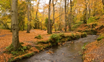
Length: 9 miles
Time: 4 hours
Start: Holywood station (Google map/OSNI Discover 15)
Finish: Seacliff Road, Bangor (Google map) Grade: Moderate
Refuel: The Salty Dog, Bangor
From busy marinas to quiet sandy beaches, this trip along the shore of Belfast Lough is a celebration of the coastal diversity a stone’s throw from the capital. The route follows a paved path just above the shoreline and is largely flat. Start by catching one of the regular trains from Bangor to Holywood. From the station, make your way to the seafront and turn right (north-east) along the promenade. In the first three miles, you pass the Royal North of Ireland Yacht Club and the Royal Belfast Golf Club.
An increasing number of sea birds pick over the coastal shelves as you enter the woodland of Crawfordsburn country park. Follow the path through the trees to Grey Point, where defensive guns were kept trained across the water throughout both world wars. It’s not long now before you reach the beach at Helen’s Bay. Cross the sand, then pass a small headland to the wider expanse of Crawfordsburn beach.
Two more secluded coves bring you to the marina in Bangor. Continue around the seafront to the Salty Dog, a hotel and bar overlooking the eastern side of the harbour. Enjoy the afternoon sun on the outdoor terrace while sampling the wide selection of local craft beer. There’s a suitably fishy slant to the menu too, with mains such as fish pie with soft-boiled egg for £12, or Ardglass turbot with clam chowder for £22.
Helen Fairbairn, author of Ireland’s Best Walks (Collins Press)
18 Glenariff, County Antrim
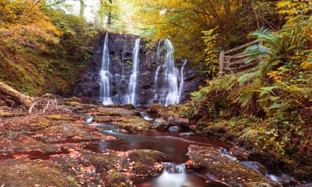
Length: 5 miles
Time: 2 ½ hours
Start/finish: Laragh Lodge car park, Glenariff (Google map /OSNI Discoverer 9) Grade: Moderate
Refuel: Laragh Lodge
This five-mile walk passes countless waterfalls, deep rocky gorges and extensive views down the Glenariff valley, one of the Glens of Antrim – with 140 metres of ascent. The circuit starts and finishes beside Laragh Lodge, the pub that provides the reward at the end of the day. Avoid temptation at the start, however, and instead follow the riverside path around the back of the restaurant. Continue ahead along the bank of the Glenariff river, with the path soon becoming a wooden walkway across a rock ravine.
At the head of the gorge is the double waterfall of Ess-na-Larach, which means “Mare’s Fall”. Cross the river here and follow the red markers upstream. At a third bridge, switch to the black waymarkers of the scenic trail, and climb through woodland to the upper reaches of the Inver river. Felling works may still be ongoing this autumn, but diversion signs mark an alternative route.
The descent traces the bank of the Inver river as far as Ess-na-Crub waterfall, then crosses both the Inver and the Glenariff. Now turn right and retrace your initial steps back to Laragh Lodge. The pub’s setting continues the watery theme. There are views of the rapids from both inside and outside, with evening floodlighting making the falls seem even more dramatic. Menu options include cracking roast pork for £11, or chicken with whisky, mustard and tomato cream for £10.95. HF
19 York City Walls
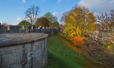
Length: 2.1 miles
Time: 1 hour
Start: York station (Google map/OS Explorer 290)
Finish: The Maltings, Tanner’s Moat (Google map)
Grade: Easy
Refuel: The Lamb & Lion, High Petergate
York’s 2.1 mile-long medieval walls are the longest and best preserved in England and, what’s more, come with a remarkable concentration of great views and points of interest. From the station (side trip to the railway museum, anyone?), I’d recommend turning left and following the road under the actual wall. You’ll spot where to get up on the ramparts. Now head back anti-clockwise around the walls to Micklegate Bar, a 14th-century gatehouse that has hosted the heads of many important noble houses – just the heads, you understand, on spikes.
A lovely long stretch of wall ends with crossing Skeldergate Bridge (the energetic can add a two-mile loop downriver to the Millennium Bridge). Once across the river, check out Clifford’s Tower – more gory history available. Further along the wall, there’s a very good pub, the Phoenix, but it only does bar snacks. A few hundred metres beyond you have to leave the wall, but at Monkgate you can reclaim the high vantage point and continue with excellent views of the Minster – this section is part of the original Roman fort wall.
The Lamb & Lion is just inside the wall at Bootham Bar. Try its version of Clifford’s Tower, a steak-and-ale pie with mashed potato (£14.95), or something lighter such as baked halloumi with tomatoes, courgettes and tempura broccoli (£10.95). The walk is well signposted, so all the ups and downs are easily negotiated. It’s free and open from 8am to dusk. At the finish, check out the Maltings for lunchtime sandwiches and a good pint of Black Sheep. There’s a detailed section-by-section guide to the walk at yorkwalls.org.uk
Kevin Rushby, the Guardian’s adventure travel writer
20 The Orchid Walk at Calke, Derbyshire
Length: 3½ miles
Time: Under 2 hours
Start/finish: Calke Abbey NT car park (Google map/OS Explorer 245)
Grade: Easy
Refuel: The Wheel Inn, Ticknall
Among all the gems in National Trust ownership, Calke Abbey ranks very high: a baroque giant of a country pile that came to the trust in 1985 in lieu of death duties, and in a state of disrepair. Thankfully they kept it that way, although “shabby” in this instance means a slightly worn cushion, rather than water pouring through the ceiling.
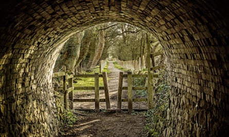
This circular walk starts at the NT car park, but you could begin at the halfway point in Ticknall if you prefer to end it with lunch, and there are several possible additions. The route takes you through Ticknall limeyards, once a bustling medieval industrial site, but now a place where lime-loving plants thrive, including wild clematis, the rare hard shield fern, wild strawberries and various orchids. After winding through this area, you will pass through an old tunnel, following which turn right along the national forest trail.
This path becomes a lane that pops out on Ticknall’s Main Street and the Wheel Inn is on your left. There’s an extensive menu, from toasted ciabattas (£8.95) to venison sausages (£10.95), plus a specials board with at least 10 dishes, around half of which are usually seafood. It’s hugely popular with locals so it’s best to book ahead.
Now retrace your steps back on to the forest trail and follow the path all the way to the abbey, watching out for some of Calke’s ancient trees, several of which are over 800 years old. The house itself is well worth a look: check out the book-lined drawing room and the wonderfully Heath Robinson bathroom equipment. More walk details at nationaltrust.org.uk. KR






Comments (…)
Sign in or create your Guardian account to join the discussion