


Best practices cited in PH response to Pinatubo blast
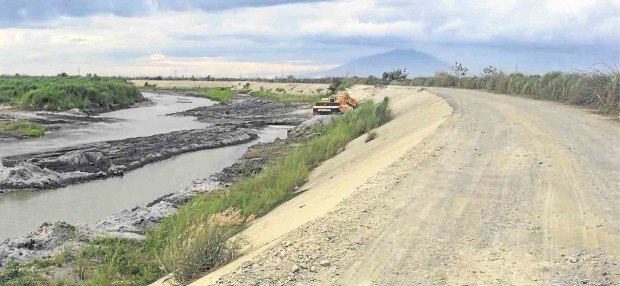
ASH, SAND and other volcanic debris that Mt. Pinatubo spewed in its 1991 eruption have spawned a quarry industry in Pampanga province. TONETTE OREJAS/ Inquirer Central Luzon
CITY OF SAN FERNANDO—Public and private responses to the 1991 eruption of Mt. Pinatubo in Central Luzon produced best practices in volcanic crisis mitigation that are being used worldwide, the Philippine Institute of Volcanology and Seismology (Phivolcs) said.
“For many years since, scientists, disaster officials and other practitioners in the field of volcanic crisis mitigation worldwide adopt and ascribe to the work accomplished in Pinatubo as best practices,” Phivolcs announced in its website.
These include the use of volcanic hazard maps, real-time seismic and sulfur monitoring, community-based information dissemination, documentaries for communicating hazards, an alert level scheme and other protocols for relaying hazards, and interagency coordination.
Dr. Renato Solidum, Phivolcs director, said he shared these best practices in a tandem presentation with Dr. Chris Newhall of the United States Geological Survey (USGS) recently at the Carnegie Institution for Science in Washington DC.
Newhall presented the pre-eruption monitoring and hazard assessment while Solidum tackled the climax and the effect of eruption and ensuing lahar.
The two scientists also emphasized the importance of collaboration, with Phivolcs saying, “the Pinatubo crisis also brought to the forefront the importance of scientists, disaster managers, local governments, and various national government agencies as well as armed forces working together for effective emergency management.”
Phivolcs said it “forged a scientific collaboration that put forth the body of basic scientific information, instrumental monitoring, communication tools and decision-making processes that proved to be ultimately life-saving.”
This was at the time when Phivolcs was led by the late Dr. Raymundo Punongbayan and the USGS Volcano Disaster Assistance Program by Newhall.
“Pinatubo’s eruption thus set the standard for effective and successful volcanic crisis management,” Phivolcs said.
It assured the public it has been monitoring and seeking scientific understanding of Mt. Pinatubo “to effectively raise awareness among stakeholders and to mainstream the use of scientific data in living with the volcano safely.”
Mt. Pinatubo, which straddles the provinces of Pampanga, Tarlac and Zambales, erupted nine months after a 7.8-magnitude earthquake rocked Luzon on July 16, 1990.
It woke back to life starting April 9, 1991, culminating on June 15 and setting out a 40-kilometer high column of ash made heavier by rains of Typhoon “Diding.”
According to Phivolcs’ accounts, “airborne volcanic ash paralyzed aviation in East Asia for days. Deadly pyroclastic flows, high-velocity mixtures of hot gas, fragmented rock and ash, rushed down all sides of the summit to distances of 16 kilometers, burying major river valleys in hundred meters of hot volcanic debris.”
“These would sooner and later spawn secondary explosions and far-reaching hazardous lahar across five major river systems draining the volcano during heavy and prolonged rains. After the climactic eruption, discrete but minor explosions occurred until September 1991,” the agency said.
By the end of 1991, the volcano discharged 5.5 cubic kilometers of magma, prompting scientists to regard it as the second largest eruption in the 20th century after Mt. Novarupta in Alaska.


