
Google has teamed up with a US company to better understand urban air pollution.
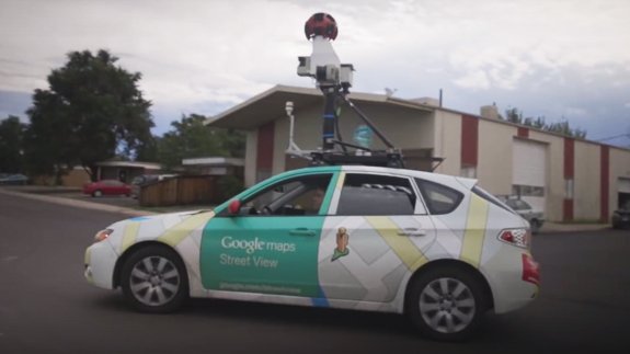
The internet search engine giant used its Street View cars with Aclima’s mobile sensing platform to see the air “in ways never before possible”.
As part of their month-long pilot programme in Denver, three Street View cars took measurements of air pollutants such as nitrogen dioxide, methane and particulate matter – all of which can affect climate change and human health.
The companies worked with the US Environmental Protection Agency (EPA) and NASA.
Currently, the EPA’s monitoring network does not give a detailed picture of a community or urban area for people to get a real sense of what air pollution is in their immediate surroundings, according to Aclima.
Google and Aclima’s technology partnership is expected introduce “a new body of knowledge about air quality at the street level”.
Davida Herzl, CEO and Co-founder of Aclima said: “Many things affect air quality – everything from our transportation and energy choices to green space and the weather. Understanding these complex relationships is critical to managing and improving air quality.
“The Denver test prepares us for scaling the system and introducing Aclima’s mobile sensing platform to communities anywhere Google Street View vehicles drive. There’s unlimited potential for our work to help improve the health and resilience of communities everywhere.”
The sensor-enabled cars are expected to hit the roads of San Francisco later this yera to gather data on the city’s air quality.