
Aided by the detailed Nizam-era village maps of the region, an ambitious project that hopes to put Telangana mandals on the country’s digital map has neared completion.
As part of the Central government’s project ‘Special Information System Decentralized Planning’ (SISDP), the Telangana State Remote Sensing Applications Centre (TRAC) is digitizing the survey maps of the State dating from 1934.
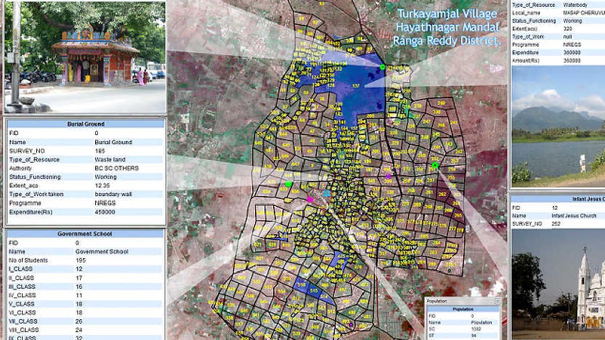
The weathered maps were drawn on cloth and they show mandal as well as village boundaries.
“Of the 10,851 maps of the Telangana region which were drawn during the survey, we have digitized most of it. It’s the only complete survey ever done in the State. Using these maps as base, we are able to draw the boundaries of villages and mandals on satellite images,” said Kiran Jella, a scientist who is spearheading the project at TRAC.
The survey maps were obtained from the Department of Survey and Land Records while National Remote Sensing Agency (NRSA) provided high resolution satellite imagery. Resulting digital map can be used by the government in any number of ways, but as of now, experts at TRAC feel that it can help with the government’s flagship project, Mission Kakatiya.
“From knowing the area under each tank to tracking implementation of the project, the digital map can be used in many ways. Telangana is among the few States where the project is under way and we are ahead of the rest in implementation,” said P. Rufus Datham, Director (admin) at the centre.
When the digital map is prepared, experts said that the government could choose to add any number of themes to it after carrying out required physical surveys and geo-tagging exercise.
For instance, a physical survey of schools could help placing them on the map, which could help know if there is adequate number of schools for any given area.
The high resolution satellite imagery combined with detailed survey records can allow monitoring of farms and take stock of changes to the State’s agricultural scenario at the micro-level.
Officials say that the centre’s next task would be to map land-use in the State, which can help generate a massive cache of information to help the government in policy making.
