- India
- International
Thursday, Apr 25, 2024
Journalism of Courage
The proposed coastal road from Nariman Point to Kandivali will include two shallow undersea tunnels, possibly the first such vehicular tunnels in the country, officials of the Brihanmumbai Municipal Corporation have said.
The two tunnels, about 5.6 km and 5.9 km long, will be constructed under water in the Arabian Sea.
One will stretch from NCPA to Priyadarshni Park near Girgaum Chowpatty and the other along the Juhu beach.
The details of the tunnels are included in the BMC’s Detailed Project Report (DPR) on the coastal road, that is now being fast-tracked.
The DPR was uploaded on the BMC website on Wednesday for suggestions from the public, following instructions to Municipal Commissioner Ajoy Mehta from Chief Minister Devendra Fadnavis.

The undersea tunnels — possibly the biggest engineering challenge in the 35.6-km coastal road that will also comprise bridges, viaducts and repurposed sections of existing road — will be constructed 20 to 30 metres below the ground.
The tunnels are being designed to cater to traffic requirement of 3 lakh vehicles per day with speed limit of 80 kilometres per hour.
With the traditional rock blasting and drilling technique not suitable for shallow tunnels, the draft report finds the use of tunnel boring machines the best construction methodology in this case. Although expensive, these limit disturbance to surrounding areas, making them ideal for heavily urbanised settings.
The report estimates requirement of about four tunnel boring machines, and the total time required to bore the two tunnels at 20-26 months at a speed of about 20-22 metres a day. The initial portions would be constructed using the cut and cover method, where a trench is excavated and roofed over, for up and down ramps.
Evacuation of passengers and vehicles from the tunnels in case of crisis is a major concern, so the tunnels are proposed to have emergency exits at cross passages every 500 metres.
The other major challenge in construction of the coastal road is expected to be the reclamation of land for 11.61 km (33 per cent of the road length).
The draft DPR says this includes 2.8 km of a mangrove stretch between the north-bound Madh Island Road and Yamuna Nagar and between Rajan Pada and Ryan International School.
In the south-bond zone, the major reclamation has to be undertaken between Priyadarshini Park and Mahalakshmi,
where 1.3 km land will have to be reclaimed along with a stretch between Baroda Palace and the beginning of the Bandra Worli Sea Link, where 1.7 km land will have to be reclaimed.
As opposed to the conventional method of reclaiming by using compactors and drains, the BMC will adopt a modern methodology where geotubes will be utilised to remove the slurry by means of increased pressure.
Discussing the Environmental Impact Assessment that will have to be undertaken separately for the project, the report recommends that appropriate amendments be made in the current CRZ notification (which does not allow reclamation) for the proposed coastal road system in Mumbai.
The draft report also suggests a sea-wall to protect the city’s coastline from severe storm surges.
Coastal road in facts and figures
> Approximate length of proposed road is 35.6 km from Nariman Point to Kandivali Junction Link Road.
> DPR envisages the road as a key component of what will eventually be a ring road around the entire 4,000 sq km Mumbai Metropolitan Region, comprising Eastern Freeway, proposed Sewri-Nhava Mumbai Trans Harbour Link, multi modal Virar-Alibag corridor and the coastal road.
> Among likely constraints to the success of the project, the report lists that it will be necessary to achieve significant reduction in travel time, provide for speedy public transport on the coastal road, deal with issues arising out of alignment passing through Coastal Regulation Zones, aesthetic issues, noise and air pollution caused by vehicles.
> It also says the issue of pedestrian movement along and across the proposed road will have to be dealt with carefully.
> With optimisation of costs key in order to achieve financial viability, the final road design alignment is hoped to achieve minimum length of tunnels, flyovers, bridges and viaducts; maximum use of existing infrastructure and land, minimum rehabilitation and resettlement, minimum impact on mangroves and other environmentally sensitive areas. Only 75 to 80 structures are expected to require rehabilitation, the least in a project of such scale.
> It states quite candidly that the coastal road traffic will mainly comprise cars, so growth rate of ridership on the high-profile project will be governed by projected rise in car ownership. For the Mumbai region, car ownership per 1,000 people in 2011 was 139 cars. The MMRDA’s Comprehensive Transportation Study estimates 266 cars per 1,000 people in MMR in 2031, but says car ownership in MMR is likely to stabilise at 180 cars per 1,000 by 2031. Those numbers are key to healthy ridership on the road.
Engineering in local language sees uptick in students in UP,Subscriber Only
How Bengaluru’s lakes disappearedSubscriber Only

UPSC Key | Ethylene oxide, SIPRI Report, organ transplantsSubscriber Only

I met nobody in rural India who saw Modi asSubscriber Only

India’s trade with Israel & Iran, and impact of regionalSubscriber Only
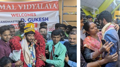
17-year-old D Gukesh, winner of the Candidates chess tournament, received a grand welcome at Chennai airport with a guard of honour from 80 students. Accompanied by his father and coach, he was greeted by officials from AICF and SDAT. His mother, relieved at his return, shared how he rediscovered himself through tennis and socializing.