


Living on ‘Hope’ at the front line of disputed islands
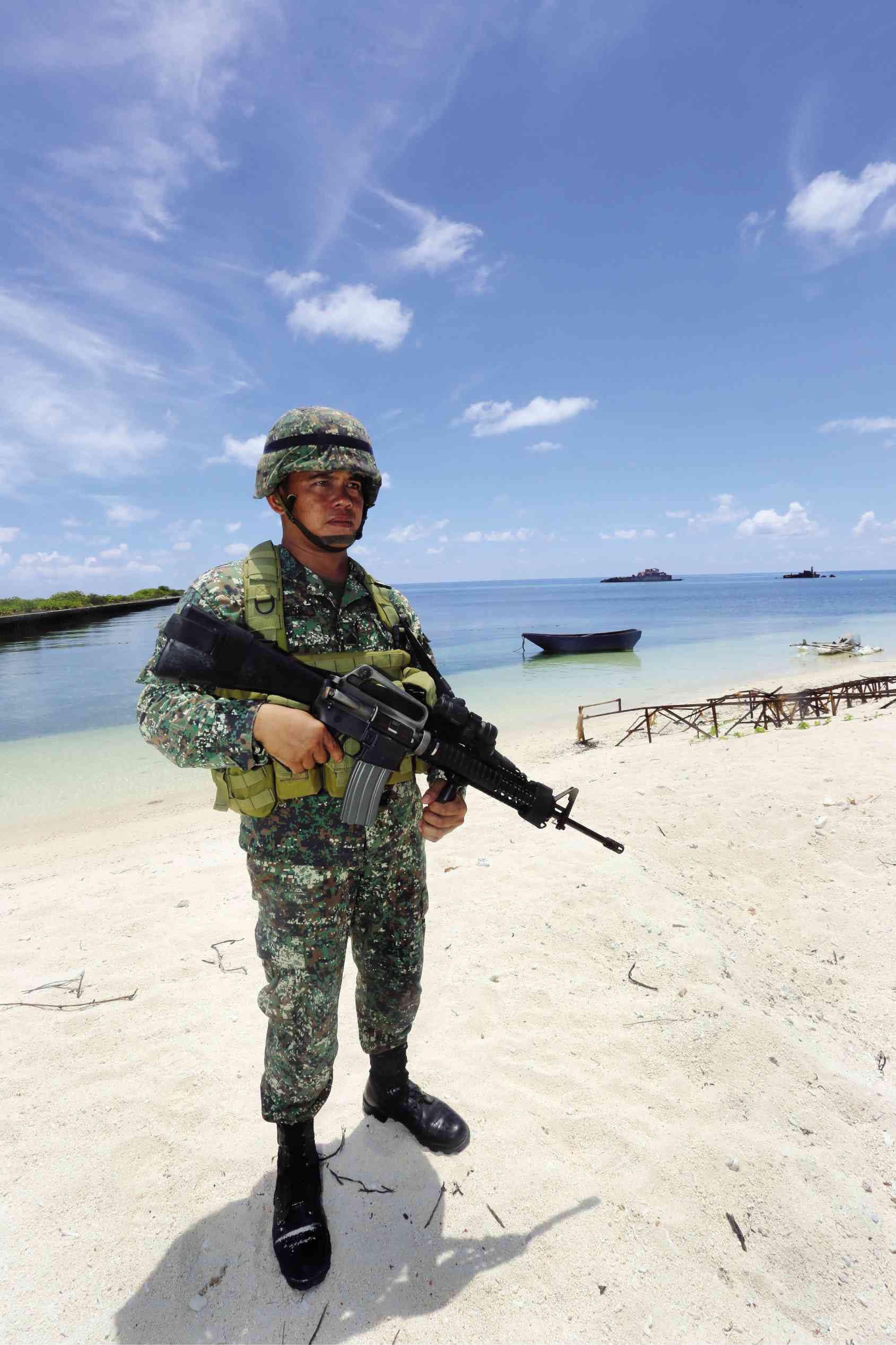
OUT OF PLACE A heavily armed soldier who’s on regular patrol along the shore of Pag-asa looks like a stranger in paradise. Pag-asa is the only inhabited island in the Kalayaan Island Group. PHOTO COURTESY OF SSG AMABLA MILAY/PAF/ PAO AFP
PAG-ASA ISLAND, Kalayaan —Waving a tiny Philippine flag, Keith, 4, merrily ran around the yard fronting the barangay hall, seemingly oblivious to the fact that his home-island in the West Philippine Sea is right in the middle of an international territorial dispute among Asian countries.
This island is at the front line of the fight between the Philippines and claimant countries, particularly China.
Keith’s father Niko Abugado, 34, watched his son with a serene look on his weathered face. Wearing the black uniform of a village watchman (barangay tanod), Abugado is also a fisherman and a former crew member of the municipal transportation vessel of Kalayaan.
The Camarines Sur native, who grew up in Puerto Princesa City in Palawan, came to the island in 2008 with his new wife, lured by talk of how bountiful the surrounding sea was.
Aside from an easy life, he found the peaceful atmosphere to his liking as it was in sharp contrast to his childhood years in Lagonoy town, CamSur. He was 9 when his parents left the province, Abugado recalled. Bothered by constant demand for food and shelter by members of the outlawed New People’s Army, his parents headed for Puerto Princesa.
Challenge, blessing
Kalayaan Municipal Mayor Eugenio Bito-onon Jr. said living on the isolated island, the international name of which is Thitu, has been both a challenge and a blessing. Considering the reclamation activities on the neighboring reefs and shoals in the West Philippine Sea by China, Vietnam and other claimant countries, he said he feared for the future of some 200 residents of the island known locally as Pag-asa (Hope).
The 372,000 square-meter island is the largest of the Philippine-administered and naturally occurring Spratly Islands, which was given the municipal name Kalayaan (Freedom) under the jurisdiction of Palawan.
Located some 480 kilometers west of Palawan’s business center, Puerto Princesa City, Pag-asa is bounded by the North Danger Reef on the north, the Subi Reef on the west, and Loaita and Tizard Banks on the south.
Of the 32 children on Pag-asa, only five, including Keith, were born on the island, Bito-onon said. Most, including the adults, came from either Palawan, Bicol or the Visayas.
Life is pretty basic, but self-sufficient, said Pag-asa Island Administrator Mary Joy Batiancila. Housing is free and deep wells provide water that is purified using a water filtration facility. Electricity comes from diesel-powered generators, while food supplies like rice, canned goods and processed meat—enough to last for three to five months—are sourced from Palawan. Other commodities like toiletries are also transported from the mainland.
Government services are available as well, thanks to a police station, a health center, Philippine Coast Guard (PCG) station, an elementary school and other local government agencies on the island.
But food shortages do occur, Bito-onon conceded, and they usually happen when trips from Pag-asa to mainland Palawan are either delayed or prohibited.
Abugado recalled a rice shortage shortly after the PCG temporarily prohibited sea travel after a storm in 1996. For three days, the residents subsisted on the corn feed they used to give to pigs, until food packages were air-dropped by government helicopters.
The municipal government used to operate its own vessel between Puerto Princesa and Pag-asa but high fuel costs made the operation untenable. Islanders now travel to the mainland and back via Philippine Navy ships that dock on the island every three months to deliver supplies to troops guarding Spratly Islands and Ayungin Shoal. The trip usually takes three to five days.
Nomad planes or Philippine Air Force (PAF) C-130s also fly to the island, often taking the Villamor Air Base-Puerto Princesa-Pag-asa route and vice versa. A one-way trip takes from one and a half hours to two hours, with the plane landing at the 300-meter sandy and grassy airstrip called Rancudo Airfield, named after former PAF commander Maj. Gen. Jose Rancudo.
The island also enjoys telecom service provided by Smart Communications, which set up a Very Small Aperture Terminal (VSAT) facility in 2011.
Cynthia Magdayao, Pag-asa program director for special projects, recounted how Pag-asa’s isolation proved to be a challenge as well to health workers and the municipal government. In 2014, when residents suffered from diarrhea because their water supply had been contaminated with coliform, she recalled how bottled water and medicines had to be air-dropped because sea travel would take too long.
Hopefully, another water treatment facility could be established on the island to avert a repeat of this crisis, Magdayao said.
Such problems can sometimes be overlooked, given the abundance of marine life around the island, Batiancila said, adding that turtles, dolphins, manta rays and various kinds of fish can be found in areas surrounding Pag-asa. Some 200,000 to 300,000 square meters of rich coral reefs in the area are also home to aquarium and commercial fish, which provide livelihood and food to islanders.
‘Secret Island’
About 5 km away is a sandbar they call “Secret Island” which is home to teeming marine life, said Batiancila’s secretary, Meldy Pernia.
But even these marine resources face an uncertain future, it seems. The island’s marine resources have attracted Chinese and Vietnamese fishermen who often gather giant clams in the area, Pernia said.
Subi Reef, only 25.7 km away, is also among the areas in the West Philippine Sea where China has been undertaking massive reclamation activities, including the building of infrastructures that have destroyed hectares of coral reefs in the area.
Bito-onon said that local police, fishermen and the PCG use facilities and transport at their disposal to protect these marine resources and chase away poachers involved in dynamite and cyanide fishing.
Sadly, he added, “We can only protect up to 1 kilometer beyond the reef fringes off Pag-asa. Beyond that, we might be facing threats from bigger sea vessels from other countries.”
Despite the hardships and challenges, Abugado said that he and other Pag-asa residents are willing to stand their ground to protect their homes.
But Bito-onon is understandably worried about the escalation of the dispute into war.
“We are at the front line of the fight between Philippines and these claimant countries,” he said.


