Coventry ring road: Building in the bombing ruins
- Published
Forty years ago, the new ring road was a vital part of rebuilding Coventry, after parts of the the city were destroyed by the Luftwaffe in 1940.
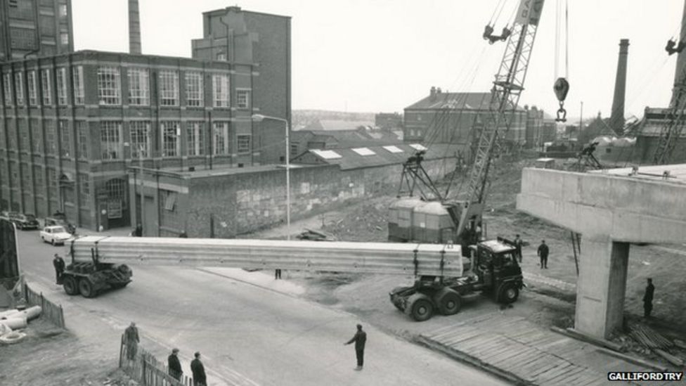
The 2.25 mile (3.62km) road took more than 14 years to build and cost £14.5m by the time it was finished in 1974.
The raised concrete roadway was built by civil engineering contractors GallifordTry.
Bomb damage created problems for the project, according to company boss Peter Galliford, as no-one knew where services such as gas, electricity and water ran.
"It was almost a day-to-day crisis situation," he said.


Brian Redknapp, one of the workers on the project, remembers how bitterly cold it was over the winter months on top of the flyover.
"There were no side panels on it and it was just like being half way up a mountain.
"It was the coldest I have ever been in my life and I still remember it to this day," he said.


Ring road facts:
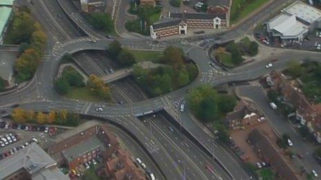
- The Coventry ring road is 2.25 miles (3.62km) long
- It has nine junctions
- The road follows the approximate lines of the old city walls
- Work started on the first section, Moat Street Flyover, Ringway Rudge and Queens, in 1962
- The final section, Ringway St. Johns and Ringway St Patrick's, was completed between 1971 and 1974

At the end of the project, workers were given a tour of the completed ring road in a bus, according to clerk of works, Tom Kirby.
"It wasn't really to show ourselves off to the people of Coventry because we'd only built a road - we hadn't won a football match," he said.
Today the ring road is used by between 40,000 and 60,000 vehicles a day, according to Coventry City Council.
- Published7 September 2014
- Published5 April 2014
- Published23 March 2014
- Published12 November 2010


